Welcome to France
Crossing a border:
Country No. 3 →
Arriving at the French Border
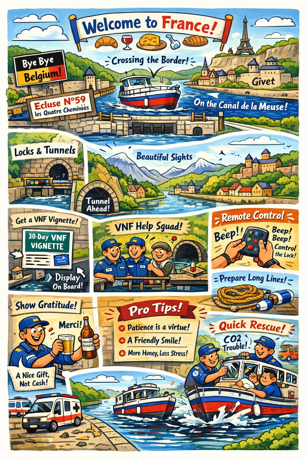
After leaving Dinant, the journey toward France is surprisingly short. In just about 2.5 hours of relaxed cruising, you will reach the French border on the Meuse. This is at Écluse French for "lock" — a chamber used to raise or lower vessels between water sections at different levels. French inland waterways have many écluses, often operated by resident lock-keepers (éclusiers) or remotely. N°59 les Quatre Cheminees, located just a few kilometers upstream of Dinant. It is a quiet but significant (and important) milestone, marking the transition from Belgian to French inland waterways.
So, France, land of wine and croissants, is one of the countries where the route travels a lot of kilometers. Leaving Écluse N°59 les Quatre Cheminees, passing Givet, the route will lead over major french waterways
Once passing Écluse N°59 les Quatre Cheminees at the border, the character of the river subtly changes. The Meuse becomes slightly narrower and more intimate, with the landscape closing in a little. The banks are greener and more wooded, and villages tend to sit closer to the water. Navigation remains straightforward, but you will notice an increase in the number of locks. And not only locks! You will find yourself navigating tunnels too.
These French locks are generally smaller and more frequent than those on the Belgian stretch of the river. The vertical lift of the locks is considerably greater than that of the Belgian locks. Therefore we advise to keep long lines and fenders ready before entering those locks. While they are well maintained and efficiently operated, locks do influence daily planning. Even relatively short distances can take longer due to waiting times, the duration of the locking operation and lock operating hours. Preparing lines and fenders in advance makes transits smoother, especially for crews new to French waterways. (Although when you ended up here, you and your crew will be well prepared for the French waterways ahead of you!)
After passing Écluse N°59 les Quatre Cheminees we are now on the Canal de la Meuse and the planning is to make some stops, to see the beautiful places. This is where the mountains really start, and the route guides along bastions, castles and citadels. It is a very nice preview of what to expect later this journey. But it's not only mountains, there are also many historic towns and villages to visit!
Obtaining a 30-Day VNF Vignette

To cruise on French inland waterways, your boat must have a valid VNF Voies Navigables de France — the French public agency managing the inland waterway network. They operate locks, bridges, and tunnels, and issue navigation permits (vignettes) for recreational boaters. vignette. This is the official navigation permit issued by Voies Navigables de France. For visiting boaters, a 30-day vignette is a convenient option that allows unrestricted use of VNF-managed waterways for one month.
The vignette can be purchased online via the official VNF website. During the application process, you will be asked to provide basic details about your vessel, including its length, type, and registration information if applicable. After completing payment, the vignette is usually issued immediately as a downloadable PDF file.
Displaying the Vignette on Board
Once purchased, the vignette must be clearly displayed on board. French authorities and lockkeepers may check compliance, so visibility is important.
It is recommended to print the vignette, preferably in colour, and protect it using a waterproof sleeve or lamination. The vignette should be placed where it is easily visible from outside the vessel, such as inside a wheelhouse window, on a cabin window near the helm, or close to the vessel's registration markings.
With the vignette correctly displayed, you are free to enjoy French inland cruising, where smaller locks, quieter waterways, and a slower rhythm of travel define the experience.
The remote control
At the first lock you can ask for the remote control, which allows you to operate the lock yourself. This is a simple device that you can use to operate the lock yourself, without needing to wait for the lockkeeper. It is a great way to save time and have more control over your journey. However, it is important to note that not all locks may have this option available, and it is always best to check with the lockkeeper before attempting to use the remote control.
Worth the money!
While being Dutch, we always look for the cheapest proper solution available. And entering France, and paying (at first glance) serious money for a vignette, might be a semi unpleasant surprise. Until you start to notice what you get in return for this! Virtually you will have your 24/7 Technician/Lock master/Bridge master/Security guard assigned to you.
Along your way trough France, whenever there is something wrong, and your boat fits within the "Freycinet" measurements, the employees of the VNF will do anything within their power to make sure you can use the infrastructure. But not only that, they will take care of your safety too.
And besides this, they will come truly asap when you are stuck in/at a lock/bridge! But very important! Your boat has to fit within the Freycinet measurements. Also, when there is something going on with the object, they will do anything possible to fix the issue.
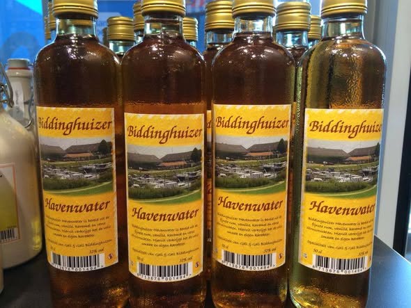
Pro Tip: If you want to show your gratitude and appreciation, the employees love to receive tokens of gratitude, rather than a tip in the form of money. Like in our case, a bottle of Harbor Water from Enkhuizen, might be one of those tokens. Naturally, comments can be found on the internet stating that they are unpleasant characters. However, a majority of people we spoke to are extremely positive about the employees. Points to consider are: Patience is a virtue, A friendly face brightens everything, Your stress won't solve the problem any faster, and You catch more flies with honey than with vinegar, Hasty Hurry is seldomly doing you a favor. (Just a few important old sayings).
Anekdote:The employees of the VNF will see if the next lock is opened by you. And if that is not the case, they will look along the stretch in between the two locks to see what is going on. Doing so, they found a boat on which the couple was overcome by CO2 and unconscious. The VNF employees arrived just in time to break the windows and get fresh air to the couple, while the fire department and ambulance had been alerted in the meantime. Thanks to this quick action by the VNF employee, the couple survived.
Permits and certificates you need in France!
Take this seriously!
Permits, Certificates and declarations
ICCInternational Certificate of CompetenceBCMRBasic Certificate Maritime Radio (Operator Certificate)
Radio Licence (Your registration of your Radio including callsign)ICPInternationaal Certificaat PleziervaartuigenPoOProof of Ownership or PurchaseInsuranceInsurance PolicyVATVAT DeclarationWaterways PermitFrench boating permit (VNF vignette)
For anyone navigating the French inland waterways with a boat longer than 5 meters and/or motorized above 9.9 hp, a VNF vignette is mandatory. You can apply for this vignette in advance via Vnf.fr (on the homepage click: "Achetez votre vignette plaisance"), but you can also buy one while en route at one of the locks near the French border. A 30-day vignette for our 8-meter vessel will cost about €119,10.
Maybe a bit old, but here you find the English PDF and the Dutch PDF
You can also directly go to the site to buy your vignette: https://vignettes-plaisance.vnf.fr/paiement-en-ligne/. The site supports the languages FR, EN, DE, NL.Make sure that you attach the permit on starboard frontside, visible under all circumstances.
Notice:
You cannot use any other permits (vignette) than the one provided by the VNF. Please read the PDF's for more information.
The French Canals
Detour, or not?
When you've watched the vlogs of the "Parel", you've seen that they had to make a detour because the Canal de la Meuse was obstructed because it was clogged with a lot of vegetation.... It added 140 km to their route. We don't plan to make that detour, but if needed, we have the information here. For both routes through France, we are going to put the (online) maps in the proper sequence here. One for the "normal" and one for the "detour" route.
Border between Belgium and France
Right before Écluse n.59 les Quatre Cheminees, the route takes us over the border from Belgium into France. At this lock you can also buy the formentioned VNF vignette. From this lock, we are heading towards Givet and therefore further into France.
Local stored information
We Dutch are not about re-inventing the wheel, so we are going to use the (very detailed) information found on french-waterways.com. This is a very nice site, with a lot of information regarding the french canals.
But we are also very aware that information can change, and therefore we have stored the relevant information from several sources here on our own site, so we always have access to it.
When you want the information we gathered ourselves, visit the local index page those routes.
Sources include, but are not limited to: EuRis, ElWis, VNF, waterkaarten.net and several local sources found on the internet.
Tunnels Tip: When entering a tunnel, report on VHF 10 indicating your direction, usually by reporting whether you are sailing upstream (montant) or downstream (avalant). In France (and Belgium), the standard call sign is for example:
"Bateau [Name boat], entre dans le souterrain de Ham, sens montant." (or sens avalant).
By doing this, you help other vessels in the tunnel to be aware of your presence and direction, which can enhance safety and coordination within the tunnel.
Local or Online Information
3rd party, or not?
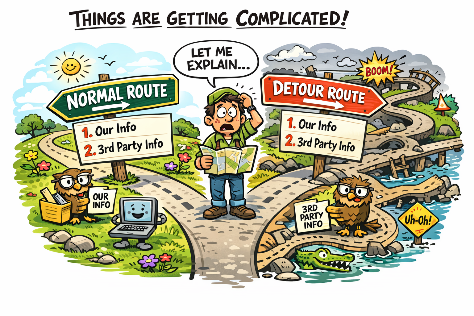
Complicated
From here on, things might become a bit complicated. Why? Let me explain. We have our information, and the information from a 3rd party website. (That is also very nice tho!) And there is the fact, that here is the normal route and the detour route:
- The normal route
- Our (local) information
- Third Party (another website) information
- The detour route
- Our (local) information
- Third Party (another website) information
Here we are, providing both local and online information. The local information is stored on our own site, so we always have access to it. The online information is from third-party sources like french-waterways.com.
So take your pick here:
Direct route to Toul (Online)
This is the drirect route
Direct Route to Toul
The direct route to Toul is approx. 140 km shorter than the detour that the Parel had to take. It's unsure if we are able to take this route, or that we have to follow the same detour.
Canal de la Meuse
We enter at Ecluse n.59 les Quatre Cheminees before entering Givet.
This section is on the direct route. Not yet taking the detour that the Parel had to take.
We will be going "on-off-on-off" on the Meuse and the Canal de la Meuse, because parts are canalised, and some parts are still river. From here on, we also will pass itunnels.The canal is also known as the Canal de L'Est.
At (PK 272.4) Lock 1 (Troussey), is the juction with Canal de la Marne au Rhin.
This is at "48° 42′ 52.72″ N, 5° 41′ 23.76″ E"Canal de la MeuseLengthApprox. 272 KilomtersBeamThe maximum beam is 5,20mDraughtThe maximum authorised draught is 1.80m throughoutHeadroomThe minimum headroom (air draught) is 3,50m above normal water levelTunnelsThere are four tunnels, at Ham, Revin, Verdun and Koeurs.Canal de la Marne au Rhin Ouest
This is the direct route. Just before Toul you will be on this canal.
This might be an option when you run out of time.
At PK 272.4 on the Canal de la Meuse, you will enter the Canal de la Marne au Rhin Ouest at PK 111.3 (Junction with Canal de la Meuse).
This is at "48° 42′ 52.72″ N, 5° 41′ 23.76″ E"
This canal also gives you the posibility to enter the Rhine at Strasbourg!C. de la Marne au RhinFull LengthApprox. 313 KilomtersLength Troussey ToulApprox. 20 KilomtersLength Moselle RiverApprox. 25 km The canalised river Moselle, entered through a new lock, from Toul to Frouard (a distance of 25km, slightly longer than by the original canal)BeamThe maximum beam is 5,13mDraughtThe maximum authorised draught is 1.80m throughoutHeadroomThe minimum headroom (air draught) is 3,60m above normal water levelTunnelsThere is one tunnel, at PK120.6.Moselle
Welcome on the Moselle. We enter the Moselle at PK 369.5 (Junction with Canal de la Marne au Rhin, western section, l/b (350m link canal with one lock))
From here, we go "up north" but in the "Afvaart" heading for Germany. This connection channel is at "48° 41′ 02.65″ N, 5° 54′ 13.57″ E"From PK 361 we are truly on the Moselle river.
La Moselle CanaliseeFull LengthApprox. 394 KilomtersLength Toul - Lux/DEApprox. 152 KilomtersBeamThe maximum beam is 6mDraughtThe maximum authorised draught is 1.50m throughoutHeadroomThe minimum headroom (air draught) is 4,40m above normal water level
Detour route to Toul (Online)
This is the detour route
Detour Route to Toul
As seen on the VLOGS of the Parel, you've seen that they had to take a detour to be able to continue their trip. This section provides the basic information for this detour.
Canal de la Meuse
We enter this at Givet.
This the detour that the Parel had to take.
The first part of the canal is also known as the Canal de L'Est.
At (PK 96.3) is the junction with Canal des Ardennes Écluse de meuse (Pont-à-Bar)
This is at "49° 41′ 38.44″ N, 4° 49′ 42.95″ E"Canal de la MeuseLengthApprox. 272 KilomtersBeamThe maximum beam is 5,20mDraughtThe maximum authorised draught is 1.80m throughoutHeadroomThe minimum headroom (air draught) is 3,50m above normal water levelTunnelsThere are two tunnels on this stretch, at Ham and Revin.Canal des Ardennes
This canal is the first stretch of the 140 km detour.
At PK 96.3 on the Canal de la Meuse, you will enter the Canal des Ardennes at PK 0.0 (Junction with Canal de la Meuse).
This is at "49° 41′ 38.44″ N, 4° 49′ 42.95″ E"C. des ArdennesFull LengthApprox. 313 KilomtersPont-à-Bar - AsfeldApprox. 88 KilomtersLength Moselle RiverApprox. 25 km The canalised river Moselle, entered through a new lock, from Toul to Frouard (a distance of 25km, slightly longer than by the original canal)BeamThe maximum beam is 5,20mDraughtThe maximum authorised draught is 1.80m throughoutHeadroomThe minimum headroom (air draught) is 3,50m above normal water levelCanal latéral à l’Aisne
At Ecluse n.14 de Vieux-les-Asfeld the Canal des Ardennes changes into Canal latéral à l’Aisne
This lock is at "49° 26′ 55.14″ N, 4° 05′ 42.81″ E"Canal latéral à l’AisneFull LengthApprox. 51 KilomtersAsfeld - Berry-au-BacApprox. 19 KilomtersBeamThe maximum beam is 5,20mDraughtThe maximum authorised draught is 1.80m throughoutHeadroomThe minimum headroom (air draught) is 3,50m above normal water levelCanal de l’Aisne à la Marne
At the basin at Berry-au-Bac, we have to make a left turn into the Canal de l’Aisne à la Marne
Here we enter Écluse n°1 | Berry-au-Bac at "49° 23′ 57.43″ N, 3° 54′ 17.47″ E"
We follow the entire length of the canal to Condé-sur-Marne where we will enter Canal latéral à la Marne by turning port (left).C. de l’Aisne à la MarneFull LengthApprox. 58 KilomtersBeamThe maximum beam is 5,20mDraughtThe maximum authorised draught is 1.80m throughoutHeadroomThe minimum headroom (air draught) is 3,50m above normal water levelCanal latéral à la Marne
At the Junction with Canal de l’Aisne à la Marne (PK 48.4) we enter the Canal latéral à la Marne at "49° 02′ 27.83″ N, 4° 10′ 50.50″ E"
We follow the 48.4 kilometers of the canal to Vitry-le-François where we will enter Canal de la Marne au Rhin by turning to port (left).C. latéral à la MarneFull LengthApprox. 67 KilomtersBeamThe maximum beam is 5,20mDraughtThe maximum authorised draught is 1.80m throughoutHeadroomThe minimum headroom (air draught) is 3,70m above normal water levelCanal de la Marne au Rhin
Now we are on our way to Toul!
At PK 0.0 on the Canal latéral à la Marne, you will enter the Canal de la Marne au Rhin at PK 0.9.
This is at "48° 43′ 48.54″ N, 4° 36′ 24.37″ E"
At Ecluse n°1 de Troussey, we pick up on the original route.
This is at "48° 42′ 52.72″ N, 5° 41′ 23.76″ E"
This canal also gives you the posibility to enter the Rhine at Strasbourg! This might be an option when you run out of time.C. de la Marne au RhinFull LengthApprox. 313 KilomtersWestern Section LengthApprox. 131 KilomtersBeamThe maximum beam is 5,13mDraughtThe maximum authorised draught is 1.80m throughoutHeadroomThe minimum headroom (air draught) is 3,60m above normal water levelTunnelsThere is a 5km tunnel at PK 86 – PK 92 Mauvages, and a 0.75km tunnel at PK 121 FougMoselle
Welcome on the Moselle. We enter the Moselle at PK 369.5 (Junction with Canal de la Marne au Rhin, western section, l/b (350m link canal with one lock))
From here, we go "up north" but in the "Afvaart" heading for Germany. This connection channel is at "48° 41′ 02.65″ N, 5° 54′ 13.57″ E"From PK 361 we are truly on the Moselle river.
La Moselle CanaliseeFull LengthApprox. 394 KilomtersLength Toul - Lux/DEApprox. 152 KilomtersBeamThe maximum beam is 6mDraughtThe maximum authorised draught is 1.50m throughoutHeadroomThe minimum headroom (air draught) is 4,40m above normal water level
Which countries will this route pass?
These are the 5 (five) countries we are going to visit. Please use the links to get to the specific chapters (or routes, or legs) of each country.
We added, for good measurement, the ISO Country and the International country-code for calling. There are objects (locks, bridges, etc) that you have to call and do not have any VHF radio. (Or we could not find the VHF information.)
List of Countries
NL - +31
Many canals & rivers (Depending on the chosen route).BE - +32
Mostly Zuid-Willemsvaart, the Albert Canal and the Meuse River.FR - +33
Meuse River, many canals and the Moselle River. Many canals because of the chance of detours.LUX - +352
Moselle River. Shortest stretch.DE - +49
The Moselle, the Saar and the Rhine River.NL - +31
Many canals & rivers (Depending on the chosen route).Of all five countries, we'll only be in Luxembourg for a short stretch: just the section of the Moselle that lies wedged between France, Germany, and Luxembourg. It starts at Écluse d'Apach (FR) and ends at Wasserbillig (LUX), where the Sauer River flows into the Moselle. On this approximately 36 km long stretch, we'll be boating right along the border between Luxembourg and Germany. More about this will follow in the section covering this part of the route.
Support the KNRM!
Help them to help others!
I would like to ask you to become a donor for the KNRM.
The KNRM is a fully private organisation, completely run by volunteers, financed by contributions and donations. You will find all information about them on the website.
You can choose from a single one time payment or a monthly or yearly donation. Please Support them.
Our personal opinion is that every person out on the water should, by law be told to make a donation of €25,- per year. But that is just our opinion.
Copyright, Disclaimer & Attribution
The legal stuff needed because of stupid....
The content on this website may include materials such as text, images, videos, and other media that are the property of their respective owners. All trademarks, logos, and copyrighted works remain the intellectual property of their original creators.
We strive to properly attribute and acknowledge all sources. If you are the copyright owner of any material featured on this site and believe it has been used without appropriate credit or permission, please contact us at [your contact email] so we can promptly address the issue.
Where applicable, the use of third-party content falls under fair use, creative commons licenses, or other applicable legal provisions. If specific attribution is required, it is provided directly alongside the respective material.
The images and data on this site are NOT intended for navigation or critical decision-making. Any reliance on this information is strictly at your own risk. The information on this site is for PERSONAL USE ONLY. You may print or copy parts of it for your own private use. Commercial use is strictly FORBIDDEN. Do not sell, rent, or use this data for profit. Unauthorized commercial exploitation will be met with rigorous legal action to the fullest extent of the law Furthermore, automated data scraping, harvesting, or feeding this content into large language models or AI systems is strictly PROHIBITED. If automated tools crawl this site without express written permission, access will be blocked, and those responsible will be held liable for unauthorized bandwidth usage and intellectual property infringement.
Powered by Haringstad
Build with VIM
© Haringstad, J and S van Koll