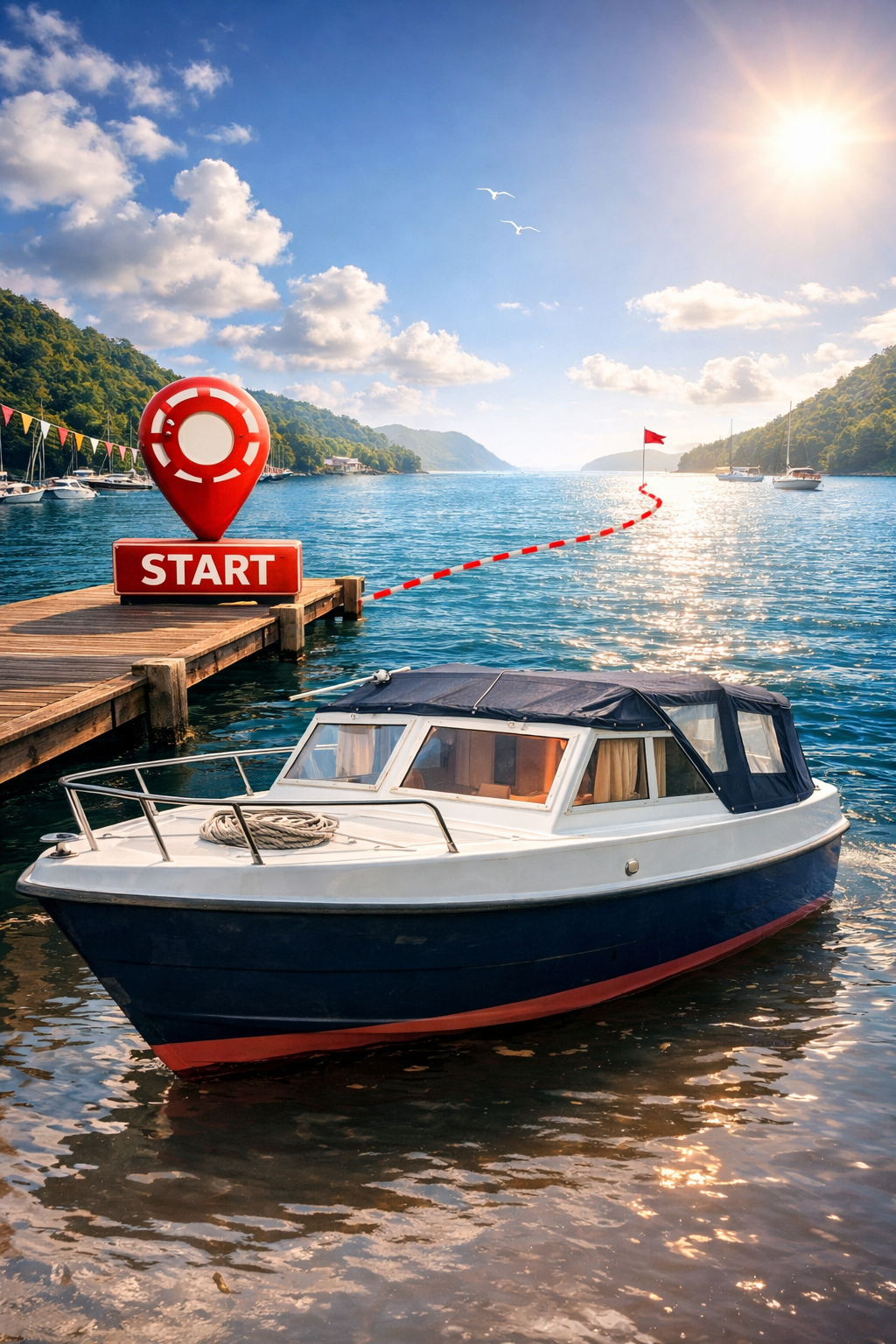
From here on, the journey and adventure truly begins. Of course, you can join the
route from wherever you like, but we globally describe the journey as it
starts from Andijk, which is our home port. As already stated, we do not
give all details of large parts of this beginning, because our waterways
are very, very well documented and we don't expect that y'all start the
journey at Jachthaven Andijk.
From Andijk, there are several routes you can take to head south. In
general, these are:
Andijk – Enkhuizen – Muiden (Compass 200° to Spar P4, Compass 201° to Spar M1)
Andijk – Enkhuizen – Amsterdam (Compass 200° to Spar P4, Compass 240° to PG-1) - IJ - ARK
And any other routes we can come up with if you want to do it more protected from wind.
Like: Andijk - Enkhuizen - Lelystad - Almere - Muiden.
Maps, and/or Apps
To follow these routes (or your own to get to Den Dungen),
you can use a water chart app, or purchase paper water charts from the ANWB
or you buy the 1800 Series for the IJsselmeer and Markermeer. Our goal is to
reach the Zuid-Willemsvaart after the bare minimum overnight stays. This means that,
weather permitting, we will prefer one of the two direct routes to Muiden or Amsterdam.
The objective is to get to the Zuid-Willemsvaart at Den Dungen where for us,
the journey and adventure truly starts.
While your journey may begin from a different starting point, this section describes
the route we recommend when travelling south, based on our own experience and practical
considerations. Departing from Andijk, we typically head in the direction of Amsterdam
or Muiden before continuing further south. This route has consistently proven to be
the most efficient option, offering a well-balanced combination of manageable distance,
reasonable fuel consumption, and comfortable daily travel times.
One of the key benefits of this route is that it avoids extended stretches of
upstream travel (opvaart)
Opvaart — navigating against the current of a river. The opposite, afvaart, means
travelling with the current downstream. Opvaart increases fuel consumption and reduces
speed over ground, making it the costlier direction on river routes.
on major rivers such as the IJssel.
The IJssel is a fast-flowing river, and travelling against its current can be both
demanding and inefficient, often resulting in higher fuel use and longer passage times.
By bypassing these upstream sections, the journey becomes calmer and more predictable,
making it particularly well suited for a relaxed and enjoyable southbound cruise.
At Amsterdam you enter the
Amsterdam-Rhine Canal (ARK)
Amsterdam-Rijnkanaal — the major commercial shipping canal linking Amsterdam to the
Rhine at Wijk bij Duurstede. One of the busiest inland waterways in the Netherlands,
used 24/7 by large cargo vessels.
At Muiden you enter the Vecht
And for both choices goes: At Weesp you can switch between the Vecht and the ARK or Vice Versa.
The route via the Vecht is incredibly scenic, but way slower because
of all the structures and bridges along the way. The ARK, in contrast,
is much faster but often has significant wave action. So it is a matter of
preference: if you prefer taking it slow and peaceful, choose the
Vecht. If you want to make progress and don't mind some rolling motion,
take the ARK. Additionally, you can now use AIS information to
estimate how busy the ARK is at any given moment.
By visiting https://www.eurisportal.eu/ you
can also see actual ship movements and estimate how busy it will be on the ARK.
This also implies that you have to "look ahead in time" to predict how busy it will
become in the coming hours.
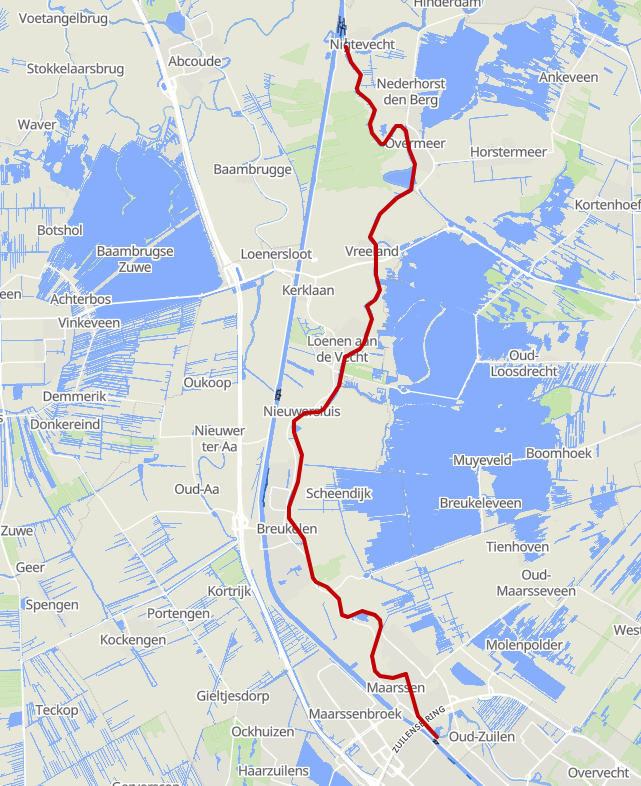
You enter the River Vecht through the Zeesluis at Muiden, where the waters of the
IJmeer meet this historic and winding river. From the very first miles, the Vecht
reveals its character: a narrow, gently meandering waterway that bends left and
right through a landscape shaped by centuries of trade, estates, and small river
towns. The route passes places such as Weesp, Nigtevecht, Loenen, Breukelen, and
Maarssen, before eventually reaching the city of Utrecht.
Along the Vecht, there are several options to leave the river and connect to the
Amsterdam–Rhine Canal (Amsterdam-Rijnkanaal). One commonly used exit is at Weesp,
where the Vecht connects via the canal through the town.
Another possibility lies further south near Nigtevecht.
A more direct but operationally sensitive transition is via the Vechtsluis (Vecht Lock)
at Maarssen, which provides access to the ARK before entering the city.
Although this takes you onto the Amsterdam-Rhine Canal for a couple of kilometers,
this is the easiest way to get you south.
Passing through Utrecht itself is also possible, but this section
is extremely busy, narrow, and heavily regulated, making it suitable only for small(er)
and highly manoeuvrable vessels. Boats such as a TOM (or similarly sized craft) can
transit this area, but larger or deeper vessels are strongly advised to avoid it.
Given the popularity of this route along the Vecht, and its excellent chart coverage, a detailed
turn-by-turn description is not repeated here. The Vecht is very well documented in
both printed cruising guides and digital navigation systems, and lock procedures,
bridge clearances, and mooring options are clearly mapped. It is therefore strongly
recommended to consult up-to-date route descriptions and official navigation
sources when planning your passage along this stream.
Via the Vecht, you can decide to take the Vechtsluis to the ARK
before reaching Utrecht. This allows you to avoid navigating through
Utrecht's busy city center. Keep in mind the clearance of fixed bridges
in Utrecht.
The lock is generally open. It is 6.5 meters wide and 32 meters
long. Using a VHF radio is mandatory on channel 62. The Burenbrug
bridge over the lock is 3.7 meters high and also 6.5 meters wide. Pay
close attention when entering the ARK! Commercial shipping moves
quickly, and you must give way!You must turn to starboard immediately and align yourself with the ARK's traffic flow.
After taking this right turn you have proper
view over the traffic and you can now plan your U-Turn.
If you decide to pass through Utrecht itself, always check the water
charts for bridge clearances and other navigational details.
Always stay aware of your surroundings and nearby vessels. ⚠️
Fig.3 - Heads up!
You will be navigating Dutch waterways. In the Netherlands, water is everywhere, and people
truly love to be in and on the water. You will share rivers, canals, and lakes
with many others: recreational boaters, swimmers, paddleboarders, kayakers, fishermen,
commercial vessels, and people enjoying the shore.
Because of this, being on the water comes with responsibility. You are not alone, even if
the surroundings feel quiet or peaceful. Always stay alert and be prepared for the unexpected.
Even on a calm and scenic river such as the Vecht, a lot can happen at the same time. For example:
A small boat may suddenly cross your path.
A swimmer or paddleboarder may be hard to see until the last moment.
A faster vessel may approach from behind.
A boat may turn without clearly signaling its intention.
To keep everyone safe, keep things simple, predictable,
and clear. Maintain a steady course, adjust your speed in time, and avoid
sudden or confusing maneuvers.
Clear navigation is a form of communication. When others can easily see what you are doing,
they can respond safely. For example, start turning early, keep a consistent speed, and give
plenty of space when passing others.
Behave as if you have eyes in the back of your head.
Look behind you regularly, especially before changing speed or direction. A quick glance can prevent dangerous situations.
Whether you are on the IJ, enter the Amsterdam–Rhine Canal (ARK) via Amsterdam, Weesp,
Nigtevecht, or from the River Vecht through the Vechtsluis, once you are on the IJ or
the ARK, the more important navigational considerations begin.
If your vessel is equipped with a VHF radio, you must monitor the
appropriate sector channels. Always listen before transmitting, keep messages short
and clear, and use the correct working channel for bridges, locks, and traffic control.
Situational Awareness
Wear your life jacket.
A life jacket significantly increases your chances of survival in the event of an unexpected fall overboard.
Even in calm conditions, accidents can happen quickly. As skipper, set the example and ensure that crew
members also wear their life jackets when appropriate.
Proper use of the VHF radio.
If your vessel is equipped with a VHF radio, maintain a listening watch on the relevant sector or traffic channels.
Commercial traffic and traffic control stations rely on these channels to coordinate safe navigation.
Listening → Always monitor the appropriate channel.
Responding → Reply when you are called or addressed.
Reporting yourself → Only when necessary, such as when entering controlled traffic areas or when requested.
Communicate clearly, briefly, and decisively. Avoid unnecessary radio traffic and keep the channel
available for essential navigation and safety messages.
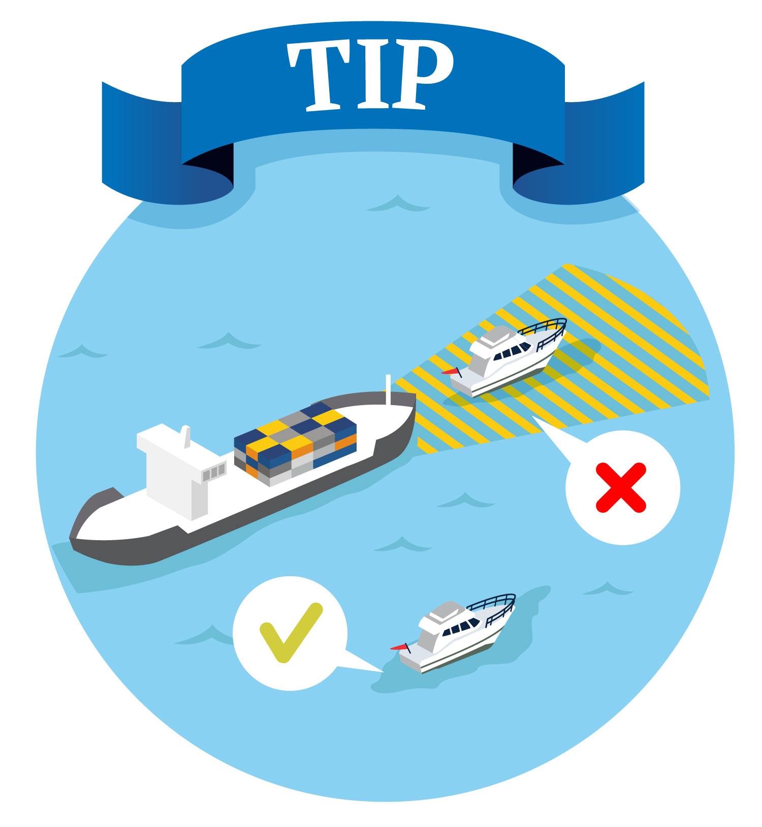
Be aware of the blind spots of commercial vessels. Fig.4 - Stay Visible!.
Large vessels often have significant blind areas directly ahead of the bow and alongside the hull.
A small recreational vessel can easily disappear from the skipper's line of sight.
If You can see the windows of the wheelhouse, the Skipper can usually SEE YOU.
If you cannot see the wheelhouse, assume that you are in a blind spot!
Ensure that your
AIS
Automatic Identification System — a transponder that broadcasts your vessel's position,
course, and speed to other AIS-equipped vessels and traffic control stations. Greatly
improves your visibility to commercial traffic.
transponder is functioning correctly if your vessel is equipped with one.
AIS improves your visibility to commercial traffic and traffic control stations.
When in doubt, you may request confirmation from the local traffic post.
Verify that your navigation lights are operational before departure.
Navigation lights may also be used during daylight hours in reduced visibility
or whenever additional visibility is beneficial.
Maintain continuous situational awareness.
Keep a proper lookout at all times. Monitor traffic movements, listen to radio traffic,
and regularly check your surroundings. Anticipate the actions of other vessels and
avoid situations that may lead to uncertainty or close-quarters manoeuvring.
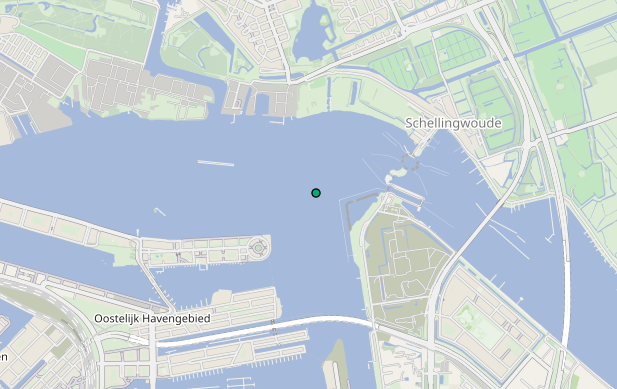
To get to the ARK from the Markermeer, you have to enter the IJ by using
the Oranjesluizen.
Use VHF 60 to communicate with the lock operator. During
summertime it might be very busy. Entering the IJ and the ARK, make sure that you
show your intentions by clear navigation. This because you immediately will enter one
of the busiest sections of the IJ:
Commercial traffic from the Markermeer and IJsselmeer to the port of Amsterdam, Noordzeekanaal or ARK.
Commercial traffic from the port of Amsterdam and Noordzeekanaal to the Markermeer and IJsselmeer.
Commercial traffic from the port of Amsterdam and Noordzeekanaal to the ARK and further inland.
Recreational traffic from the Markermeer and IJsselmeer to the port of Amsterdam, Noordzeekanaal or ARK.
Recreational traffic from the port of Amsterdam and Noordzeekanaal to the Markermeer and IJsselmeer.
Recreational traffic from the port of Amsterdam and Noordzeekanaal to the ARK and further inland.
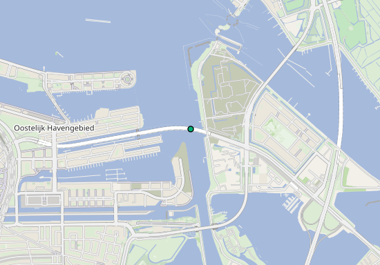
When exiting the Oranjesluizen,
you almost immediately hit km 00.0 of the ARK.
Right now you can choose to refuel at the north side of the IJ. This is up to you.
This is where the route to the mouth of the real canal part of the ARK is:
Head for buoy "Stomp IJ 18" (RED)
At "Stomp IJ 18" (RED), turn starboard to cross the fairway and head for buoy "IJ-11" (GREEN).
Now turn starboard to Compass 155° between buoy "IJ-11" and Spar "G" and follow the
"IJ" buoys line until Spar "M" and buoy "IJ-25".
Here you enter the Amsterdam Rhine Canal. Make sure you keep east from the yellow buoys
line in the entrance of the Amsterdam Rhine-canal (ARK).
Bunkering on the IJ at Amsterdam
There is a fuel station on the North side of the IJ:
Tankstation / Bunkerstation
Steiger Reinplus
Nieuwendammerdijk 526s
1023 BX Amsterdam
North Shore at "Stomp IJ 18 (RED)"
There are two fuel stations on the East side of the ARK entrance:
Tankstation / Bunkerstation
OK Slurink
Zuider IJdijk 100
1095 KN Amsterdam
East Shore at "KM 1.0" Only for commercial vessels, no Watersports Tankstation / Bunkerstation
Steiger Fiwado
Zuider IJdijk 100
1095 KN Amsterdam
East Shore at "KM 1.2"
You are now on the ARK (Amsterdam-Rijnkanaal) between KM 1.0 and KM 1.2.
You've passed two bunker stations where you could have gotten Diesel.
The last bunkerstation before getting into the
narrow part of the canal is right at KM 1.2. You can get diesel at some
marinas along the way, like at Marina "Bovendiep" in the Nieuwediep.
The next Bunkerstation is at Utrecht (KM 35.5)
And you are on your way to the fork at the "De Plofsluis", heading from there
towards Wijk bij Duurstede, or the Lekkanaal and Vianen, or even further.
On these first 10 kilometres there are a couple of side canals,
and harbor entrances. Listen to
VTS
Vessel Traffic Service — a shore-based monitoring and coordination service for busy
waterways. VTS operators use radar, AIS, and VHF radio to manage traffic flow and
provide navigational assistance. Listening to the VTS channel is mandatory on many
commercial waterways.
channels during this stretch.
Check for VTS channels on your maps, or the signs on the shore.
Skippers information about the ARK between KM 0.0 and the Plofsluis
Objects between KM 0 and the Plofsluis
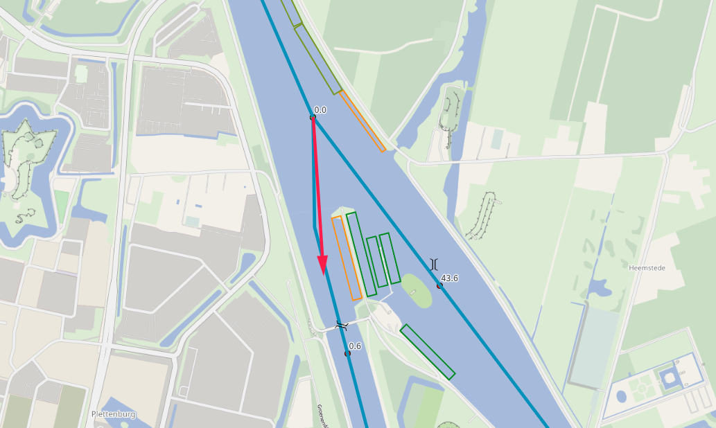
As you leave the Oranjesluizen and enter the ARK, you will encounter a series of distinct navigational
features and transition points. These include:
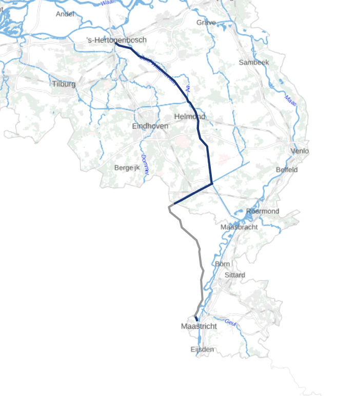
Heading Toward the Zuid-Willemsvaart
About Canals, Rivers, Op- and Afvaart
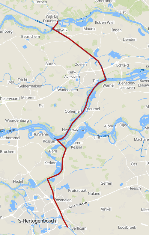
Fig.5 - Route Wijk bij Duurstede - Den Dungen.
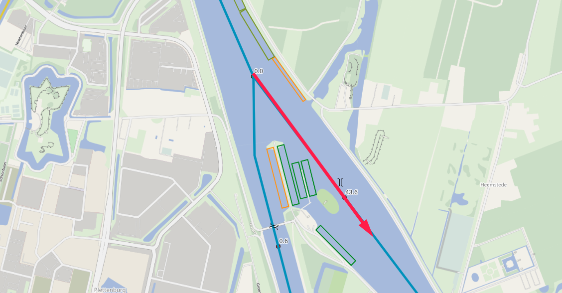
You are now approaching the
Plofsluis
A defensive dam structure near Nieuwegein, built between 1937 and 1942 as part of
the New Dutch Waterline. Designed to block the Amsterdam–Rhine Canal in wartime by
detonating concrete caissons filled with sand and gravel, flooding the surrounding area.
at Nieuwegein. This structure marks an important decision point in the route.
The Plofsluis itself is located at approximately Amsterdam-Rijnkanaal (ARK)
kilometre 43.6. Here, the Amsterdam-Rijnkanaal intersects with the
Lekkanaal, and you must choose how to continue your journey.
The Amsterdam-Rijnkanaal is one of the busiest and most important
commercial waterways in the Netherlands. It is wide, deep, and designed for heavy
professional shipping, with frequent passage of large inland vessels travelling at
relatively high speeds. Navigation here requires continuous attention, clear radio
communication, and confident boat handling, but it allows for fast and direct progress
with fewer interruptions.
The Lekkanaal, by contrast, offers a transition away from the intensity
of the ARK. While still a major navigable waterway, it generally carries less through-going
commercial traffic and has a calmer, more enclosed character. Choosing the Lekkanaal often
feels like leaving the main transport corridor and entering a more controlled inland route,
setting the tone for the waterways that eventually lead toward the Zuid-Willemsvaart.
From this junction at the Plofsluis, both routes will ultimately guide you
toward the Zuid-Willemsvaart at Den Dungen, but they differ in atmosphere,
traffic density, and the type of waterways you will encounter along the way.
Turn to starboard on the ARK before the plofsluis to follow the scenic and
well-known route taken by de Parel. This course leads you via the Lekkanaal in the
direction of Vianen, exactly as shown in the vlog series by
de Parel.
Because this route has already been documented in great detail in the
Parel vlog, we will not repeat that description here. Be aware that this
stretch includes numerous locks, bridges, and other structures, and involves
traveling upstream (opvaart). As a result, it is generally
the slower and more costly option in terms of time and fuel consumption.
Route Information to Den Dungen
Length
Approx. 65 Km
Travel Time
Estimated 15 hours
Objects
34 Bridges, 6 Locks
Skippers information about the Lekkanaal
Objects between KM 0 and KM 4
Ultimately, route planning remains entirely your own responsibility. If you
have sufficient time available and do not mind traveling in the opvaart, you
are free to choose any route that suits your preferences. Reaching the
Zuid-Willemsvaart can be done in several ways, depending on your
overall planning.
In fact, if conditions and your planning allow, it is even possible to continue
upstream all the way to Luik (Liège) by following the
River Meuse.
Turn to port at the Plofsluis and continue on the
ARK towards Wijk bij Duurstede. This route offers a
good amount of downstream current ("afvaart") later on,
making it the cheaper route in terms of fuel consumption. It is also our preferred route towards the Maximakanaal.
Historic object: The Plofsluis near Nieuwegein, built
between 1937 and 1942 as part of the New Dutch Waterline, is a unique defensive
structure designed to dam the Amsterdam–Rhine Canal in the event of war.
By detonating the bases of concrete caissons filled with 40,000 metric tonnes of sand
and gravel, the canal would be blocked, making it possible to flood the surrounding area.
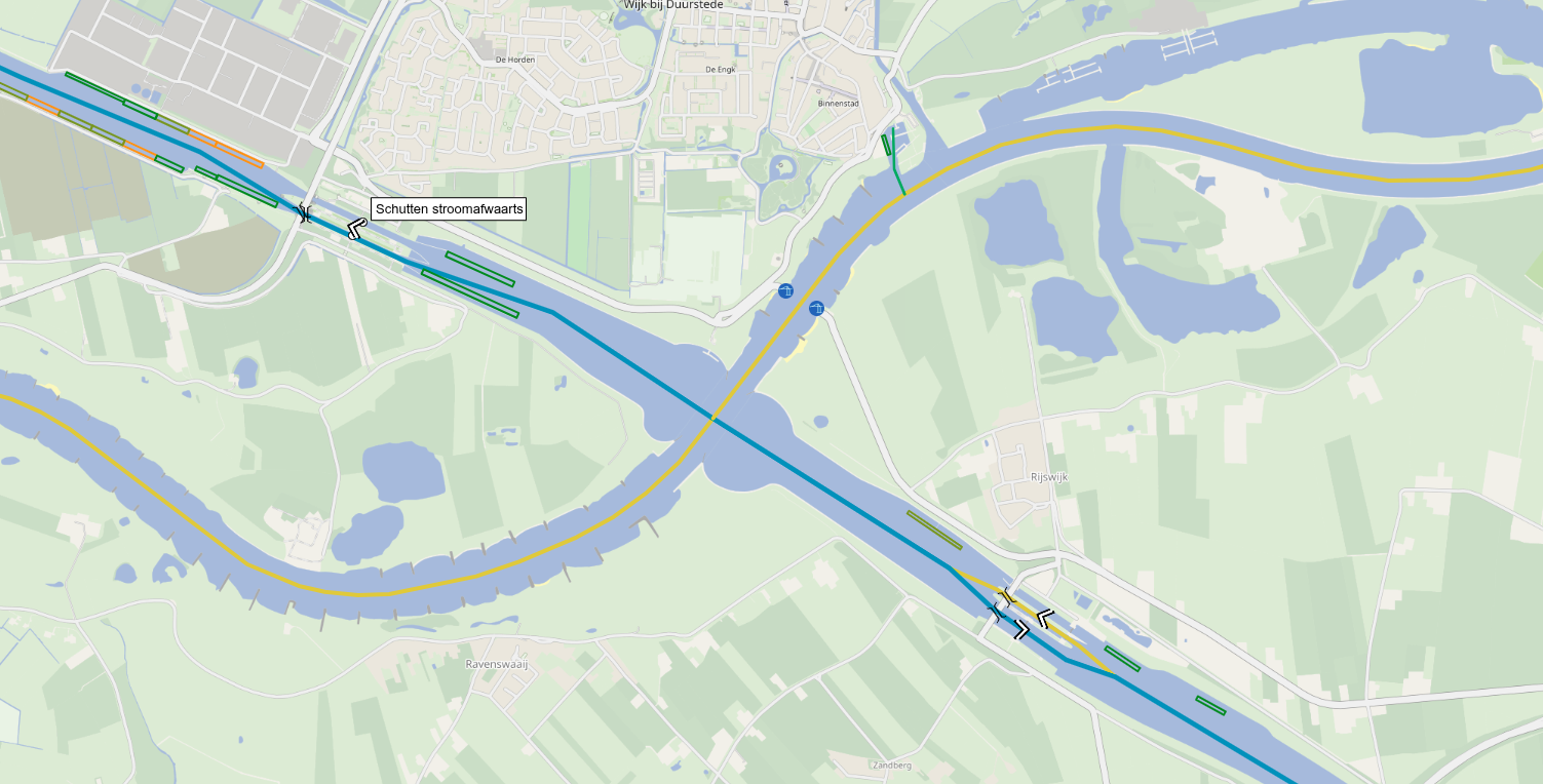
Nieuwegein - Wijk bij Duurstede
On this section of the ARK between Nieuwegein and Wijk bij Duurstede you will pass some
objects:
The crossing at Wijk bij Duurstede lies between the locks
"Princess Irene" and "Princess Marijke"
that "guard the ARK" from the changing waterlevels in the
Rhine and Lek rivers.
At the crossing
At this crossing there are 4 waterways:
The ARK continues here, separated by 2 locks on each side of the intersection.
The Rijn AKA the Nederrijn comes down here from Arnhem.
The Lek is the continuation of the Nederrijn after the crossing.
And that is a bit weird, due to the fact that the KM numbering of the
Rhine river just continues on the Lek river......
Wijk bij Duurstede
The city harbor of Wijk bij Duurstede is really connected to the old
town and just a stone throw from the nearest supermarket. At about 8
minutes walk you'll find an Albert Heijn. Nice spot to stay for the
night. There is an old "castle" ruin and nice restaurants. Wijk bij
Duurstede is located at the crossing of the Lek river and the
Amsterdam-Rhine Canal. From here you can also choose to continue on the
ARK to the Waal. Or now take a detour over the river Lek. For that, you
should use your own water-maps and do your own planning because that is outside the scope of
this guide.
Wijk bij Duurstede is also known as the place of how far the Vikings travelled
in-land
This section goes from Wijk bij Duurstede (the crossing) to the connection
of the ARK with the Waal River. Make sure you listen in to the appropriate
VHF channels and announce yourself at Traffic Post "Tiel" on VHF 69.
Always listen to the Traffic Post's advices. Their Radars see more than you in your
small yacht!
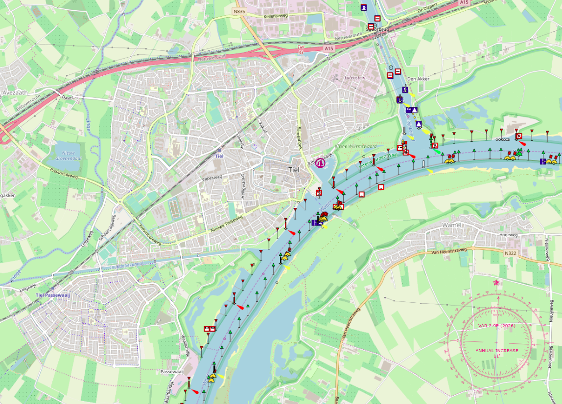
ARK: Wijk bij Duurstede - Tiel
Objects between Wijk bij Duurstede and the Waal river
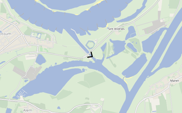
River Waal – Downstream to the Kanaal van Sint-Andries (±15 km)
Fig.6 - Entering the Waal
Entering the River Waal, we proceed
downstream (westward, starboard, right turn) for approximately
15 kilometres toward the Kanaal van Sint-Andries.
The Waal is the busiest branch of the Rhine and forms a major
international shipping route between Germany and the Port of Rotterdam.
Expect intensive commercial traffic, including large
container ships and pushed barges, often travelling at considerable speed.
The river is wide and powerful, with a strong current
that works in our favour while going downstream. Depending on discharge
levels, the current can add approximately
2–4 km/h to your
speed over ground (SOG)
Speed Over Ground — your vessel's actual speed relative to the earth's surface,
as opposed to speed through the water. On a river with current, SOG is higher
when going downstream and lower when going upstream.
.
Continuous steering attention is required. Passing commercial vessels
generate significant wash and suction, particularly
near bends and when overtaking or being overtaken.
Navigation Notes
Keep well outside the main fairway where possible
Cross the shipping lane only when necessary and decisively
Monitor VHF traffic information if available
Watch for buoys, groynes, and shallow edges along the banks
After turning starboard on the Waal, continue downstream
to approximately river kilometre (KM) 925. From the point
where the Amsterdam–Rhine Canal (ARK) enters the Waal,
this stretch measures about 12.7 kilometres.
This section requires monitoring VHF channel 68
(Blok Kanaal St. Andries). Maintain a listening watch well in
advance, as commercial traffic coordination is essential.
Objects between Tiel and the Canal Sint-Andries
At around KM 927(passed the mouth of Canal St. Andries),
cross the River Waal decisively and navigate back toward
the entrance of the Kanaal van Sint-Andries. This canal
leads directly to the St. Andries lock, marking the
transition from large-scale river navigation to a more controlled inland
waterway with noticeably calmer conditions.
Both Canal and Lock St Andries connect the MAAS and
the WAAL rivers.
Together, the canal and lock form a short but important navigation link in the Dutch river system.
The canal provides a protected cut between the two rivers, while the lock manages the water-level
difference and controls the exchange of water and traffic between the waterways.
Canal St Andries is the engineered channel that physically links the two river environments.
It is typically experienced as a relatively sheltered stretch compared to the main river fairways,
making it easier to prepare for the next river leg: fenders and lines ready, crew briefed, and
traffic checks done before entering the lock approach.
For skippers, this connection can be a practical alternative when planning a route between the Maas
and Waal corridors. It can help avoid long detours, and it offers a calmer, more controlled transition
than entering the other river directly in open flow conditions.
Objects on the connection channel with lock between the Meuse and Waal river
Lock St Andries is the control point of the connection. It organizes traffic in both directions and
makes the transition between the Maas and Waal manageable by lifting or lowering vessels as needed.
As with most locks, expect waiting times to vary with traffic, commercial shipping priority, and
operational circumstances.
Practical notes for skippers
Approach: slow down early and keep a good lookout; lock approaches can be busy.
Lines & fenders: rig on both sides if possible; have at least one long line ready.
Communication: follow local signage and instructions; monitor the relevant VHF channel if posted.
Current & wind: conditions can change quickly near river mouths—brief the crew before entering.
After the lock: allow room to merge and accelerate safely before committing to the main river flow.
So from here: Kanaal van Sint Andries → Meuse → Maximakanaal
→ Zuid-Willemsvaart.
You now enter the Maas (Meuse) river at
about KM 209. And we go starboard, in the "Afvaart". Weird ey? No, not
really, because from here, it is only 6,5 KM to the entrance of the
"Maximakanaal". And that canal will bring us straight to the location
where the Maximakanaal will end up in the Zuid-Willemsvaart.
On the Meuse, at marker 215, cross the river to the entrance of the
Maximakanaal. Do this again by passing the mouth of the Maximakanaal, make a U-Turn
and enter Maximakanaal going "upstream"
At the same marker, you can also choose to stay at Marina "Neptunus"
before entering the Maximakanaal.
Note: The KM down here are the KM markers of EURIS! We made links to
the water-map locations so you can compare this with your maps.
By taking the Maximakanaal, you avoid the center of Den Bosch and the busy traffic there.
The canal is a straight cut through the landscape, with a couple of locks and bridges.
It is a nice stretch to do, but it is not very scenic. It is more of a "get-there" type
of waterway.
Communication
Make sure you announce yourself at Lock Empel Noord (VHF 81).
This lock is operated from Operation Central Tilburg.
Leaving lock Hintham
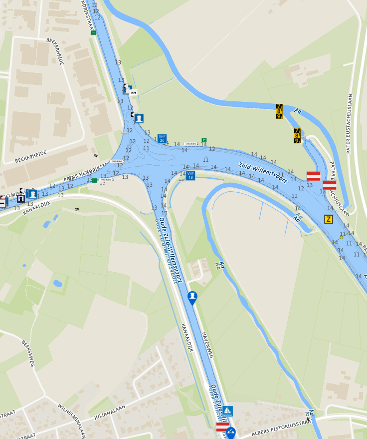
and the last part of the Maximakanaal, enter the Zuid-Willemsvaart at N 51°40.830', E 5°22.379'
(Raai or KM 117.5). We are going to follow the Zuid-Willemsvaart until we reach the fork at
Neerharen.
But first we have to continue to Weert and have to make a starboard turn at
Nederweert to continue the rest of the Zuid-Willemsvaart.
Close to Lozen, we are going to cross the
border into Belgium where the ZWV continues.
We are going to cut these sections on the ZWV up, from Marina to Marina. Else it might get a bit
unreadable. So from here, we continue to Veghel, where the first marina is. This way it might be clearer
where certain objects are. It is always difficult to write for both yourself and others at the same time.
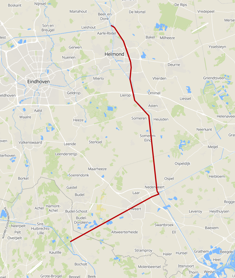
After (passing the entrance of) Marina Veghel, the route continues to Aarle-Rixtel.
Here is also a very nice marina. This is also the marina where the Parel moored and
that is our preferred stop for this stretch.
To be honest, the stretch from Den Dungen to Aarle-Rixtel is doable in a single day.
Arriving at the crossing at KM 89.8, you go straight into the (free) marina of Aarle-Rixtel
like the "Parel".
On this stretch of the Zuid-Willemsvaart from Veghel to Aarle-Rixtel,
you will pass some objects:
This junction marks the crossing of the Zuid-Willemsvaart,
coming from the direction you are travelling.
At the crossing, the Wilhelminakanaal branches off to starboard
(right-hand side).
Straight ahead lies the old stretch of the Zuid-Willemsvaart,
where the marina is located. This section is blocked at the bridge in Aarle-Rixtel and is only
accessible for the part between the crossing and the bridge at the end of the marina.
The new stretch of the Zuid-Willemsvaart continues to port
(left-hand side) and is the route to take when continuing your journey.
Due to the fact that we write these routes from our point of view
it implies that we stay the night at the marina at Aarle-Rixtel.
We continue our way by leaving the Marina and making a turn to starboard
at the crossing, to continue on the next stretch of the Zuid-Willemsvaart
We are aiming for the marina in Weert.
On this stretch of the Zuid-Willemsvaart from Aarle-Rixtel to Nederweert,
you will pass some objects:
After (leaving) the mini-marina at Nederweert with only 6 places,
the semi-crossing is coming up, between the ZWV, the Noordervaart (on port side),
Canal Wessem - Nederweert (straight ahead heading towards Maasbracht)
and the last part of the ZWV on starboard.
Here turn starboard into the last part of the ZWV to get to lock
15. Right after this lock there should be a possibility to refuel, although this is
a bit unsure.
As stated, along this part, there are some places to refuel. Just before crossing
the Belgian - Netherlands border, there is a gas station in The
Netherlands. Please be aware about pricing on the pump at the water-front.
Most of the time the price here is way higher and it might be smart to gas
up with jerrycans. although this might be a little more work, it might save
enough €€€!
It might be cheaper to refuel in Belgium!
On this stretch of the Zuid-Willemsvaart from Nederweert to Weert,
you will pass some objects:
Staying at Weert?
Our original plan was to stay here at Weert. But it might be a bit different. We might have
slept in Nederweert. So, yep, we continue from here.
On this stretch of the Zuid-Willemsvaart from Weert to the Belgian Border,
you will pass some objects:
It is possible to navigate from Weert (NL) to Kanne (BE) in one single trip!
Also be aware of the openings-information for
Lock 17 (Lozen)
These are the 5 (five) countries we are going to visit. Please use the links
to get to the specific chapters (or routes, or legs) of each country.
We added, for good measurement, the ISO Country and the International country-code
for calling. There are objects (locks, bridges, etc) that you have to call and do not
have any VHF radio. (Or we could not find the VHF information.)
NL - +31 Many canals & rivers (Depending on the chosen route).
Of all five countries, we'll only be in Luxembourg for a short
stretch: just the section of the Moselle that lies wedged between
France, Germany, and Luxembourg. It starts at Écluse
d'Apach (FR) and ends at Wasserbillig (LUX),
where the Sauer River flows into the Moselle. On this approximately 36 km
long stretch, we'll be boating right along the border between Luxembourg
and Germany. More about this will follow in the section covering this
part of the route.
We try to update this website as often as possible!
The upgrade plans
24 Januari 2026
Our upgrade plans.
Support the KNRM!
Help them to help others!
KNRM
I would like to ask you to become a donor for the KNRM.
The KNRM is a fully private organisation, completely run by volunteers, financed by contributions and donations.
You will find all information about them on the website.
You can choose from a single one time payment or a monthly or yearly donation. Please Support them.
Our personal opinion is that every person out on the water should, by law be told to make a donation of €25,- per year.
But that is just our opinion.
Copyright, Disclaimer & Attribution
The legal stuff needed because of stupid....
The content on this website may include materials such as text, images, videos, and other media that are the property of their respective owners. All trademarks, logos, and copyrighted works remain the intellectual property of their original creators.
We strive to properly attribute and acknowledge all sources. If you are the copyright owner of any material featured on this site and believe it has been used without appropriate credit or permission, please contact us at [your contact email] so we can promptly address the issue.
Where applicable, the use of third-party content falls under fair use, creative commons licenses, or other applicable legal provisions. If specific attribution is required, it is provided directly alongside the respective material.
The images and data on this site are NOT intended for navigation or critical decision-making.
Any reliance on this information is strictly at your own risk. The information on this site is for PERSONAL USE ONLY.
You may print or copy parts of it for your own private use. Commercial use is strictly FORBIDDEN.
Do not sell, rent, or use this data for profit. Unauthorized commercial exploitation will be met with rigorous legal action to the fullest extent of the law
Furthermore, automated data scraping, harvesting, or feeding this content into large language models or AI systems is strictly PROHIBITED.
If automated tools crawl this site without express written permission, access will be blocked, and those responsible will be held liable for
unauthorized bandwidth usage and intellectual property infringement.